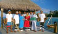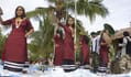
Maldives is a country of over a thousand islands spread over 298 square kilometres of the Indian Ocean. Uniquely charming, endowed with a dreamlike beauty unknown elsewhere in the world. The Maldives welcomes travellers to enjoy its natural splendour and charm and the hospitality of its people.
The country is home to about 520,000 islanders yet welcomes thrice as many to its shores yearly. The Maldives has welcomed visitors with open arms for centuries. Some opted to stay, while some wrote about the mysteries and intricacies of life on these tiny islands. Unlike the adventurers and mariners of the past, today, the Maldives is easily accessible from anywhere in the world.
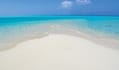
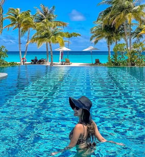
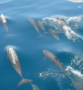
For most holidaymakers, great sunny days with deep blue skies, clear lagoons with pleasing shades of blue, moonlit nights, the soothing sound of little waves lapping the soft white sands, the ruffle of palms and powdery white beaches are the basic ingredients for the perfect tropical holiday. Few places offer these ingredients in greater abundance than the Maldives.
Although the Maldives is well known to travellers and holidaymakers today, its long history has yet to be discovered. The Maldives has gone through immense changes and has been affected by geopolitical changes and upheavals that have swept through the world throughout the last two millennials.
Geography
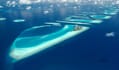
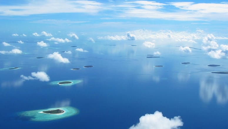
Few countries have a landscape as remarkable as that of the Maldives. The Maldives is an archipelago of 1190 islands that straddle the equator, about 650 km southwest of Sri Lanka. The islands are scattered in a chain-like formation extending 820 km from north to south and 130 km at its widest point.
The islands form ring-shaped formations or atolls, 26 in all, some with a single island and others with over 200 islands. Huvadhoo Atoll in the south is the second largest atoll in the world.
Atoll formation
In 1842 Charles Darwin presented the world with the first acceptable theory of atoll formation. Darwin proclaimed that atolls were created when a volcanic land mass subsided slowly into the ocean while coral built up and out around the plateau. However, Darwin also wrote that the formation of Maldives was somewhat different from the islands of the Pacific and Atlantic that he had examined.
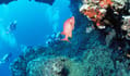
After a diving expedition in the Maldives in 1962, Hans Hass concluded that 'the inner structure of certain coral reefs are not compact but porous and unstable. Hence extended reef platforms invariably sag in the centre". Reefs formed on the peaks of the submerged mountain range that extends through the centre of the Indian Ocean.
The reefs eventually pierce the ocean's surface, beginning to form platforms. The centre of the platform collapses due to the scarcity of food and oxygen and the massaging effect of the tides.
However, around the rim of the atoll where the coral has been built the hardest and highest, sand and debris accumulate, vegetation takes hold and islands begin to form.
How the Maldives formed
The mysterious formation of the Maldives began more than 225 million years ago when only the hydrosphere and lithosphere existed. At that time, more than half of the Earth consisted of a continent called Pangaea. This continent was surrounded by an ocean called Panthalassa.
About 136 million years ago, Pangaea was divided into two continents. The northern continent was called Laurasia, and the southern one was called Gondwana, and between them was a sea called Tethys. Next, Gondwana broke apart and formed the Atlantic Ocean, separating the African and American continents.
The continents were scattered because of plate movement. Then lava erupted from the Earth's core, forming an underwater landscape. The Laurasia also broke up and formed the northern hemisphere continents about 6,600 years ago.
The Indian Ocean began to take shape about 150 million years ago. At that time, India was part of the southern continent. Asia, on the other hand, was part of the northern continent "Laurasia".
During the abovementioned period, the plate movement caused India to split off from Madagascar and Africa and gradually began to move northward. As this plate moved through the Indian Ocean, it passed through a hotspot. This hotspot, located near present-day Reunion Island, is said to have played a special role in the formation of the Maldives.
Scientific studies have confirmed that the uplift that runs from the Chagos Archipelago through the Maldives to Lakshadweep Deep was formed by passing through the hotspot. The passage of the hotspot created a long volcanic belt that extended all the way to the Indian Plate.
After a long journey, the northern end of the Indian plate collided with the southern end of the Asian plate. The impact created the huge Himalayan Mountains. The Indian Ocean was then outlined.
The volcanoes that were the ancestors of the Maldives gradually began to sink into the Indian Ocean over a long period of time. The topography of the Maldives at that time was an island consisting of volcanoes and highlands. However, the mountains gradually sank into the Indian Ocean, leaving only the crater at the top.
After millions of years, the tops of the remaining mountains started forming thousands of beautiful coral reef islands. Today Maldives has no mountains and no volcanoes, and the highest point to the sea level is about 2.4 metres.
Names of the atolls
The Maldives is made up of 26 atolls of various sizes. The word "atoll" has two meanings in the local language, Dhivehi: a geographical atoll and the other is the atoll as an administrative district.
The 26 geographical atolls are divided into 20 administrative atolls. The smaller atolls are grouped in the same administrative area as the larger ones.
The geographical atolls are called by their traditional names, such as Thiladhunmathi, Faadhippolhu and Addu. The atolls in the administrative district are named with the letters of the Thana alphabet in order from north to south.
Therefore, the northernmost administrative atoll, the northern part of Thiladhunmathi, is called Haa Alifu Atoll. Haa is the first letter of the Thaana alphabet, and Alifu means the northern part of Haa Atoll. The Maldivians use both traditional and alphabetic names, which often confuses tourists.
In addition, maps of the Maldives sometimes use the traditional English versions of names. For example, Huvadhoo Atoll in the south is sometimes marked on maps as Suvadiva Atoll.
- Introduction to all atolls
The 209 islands stretching 140 km to the north of the Maldives are divided into four administrative regions. These are Haa Alifu, Haa Dhaalu, Shaviyani and Noonu. The people of this area are mainly engaged in fishing. There are also some uninhabited islands where agriculture is practised.
There are also many people who have left their homes far behind to work in the resorts in the central area. However, recently there are many luxury resort islands opened in this region. The island of Kulhudhuffushi in Haa Dhaalu Atoll is these four atolls' commercial and social centre. It is a very important island, especially for the northern part of the region.
The administrative Raa Atoll coincides with the geographical Raa Atoll. However, the smaller atoll of Alifushi also falls under its jurisdiction. According to Maldivian Folklore, Koimala, a prince from the Indian subcontinent, arrived on the island of Rasgetheem in Raa Atoll, and later he moved to Male around 1100 BC.
Baa Atoll is made up of two natural rings. The main part of this administrative area is a medium-sized atoll to the south of Raa Atoll. The other part is a tiny area called Goidhoo with only three islands (Goidhoo, Fulhaadhoo and Fehendhoo). The French explorer François Pyrard was marooned for five years in this area after his ship Corbin ran aground in 1602.
Lhaviyani Atoll is a small area, only 37 km wide and 35 km long, located 120 km north of Male. Of the 60 islands in Lhaviyani Atoll, only five are inhabited. However, some of the uninhabited islands are used for various purposes. There are several resort islands, the oldest of which, Kuredu Island Resort, opened in 1978.
The primary industry for the islanders in this region is fishing. Naifaru and Hinnavaru are home to over 5,000 people and a large fishing fleet. The atoll was the site of the first fish cannery in the Maldives.
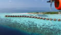
Kaafu Atoll is made up of four atolls: North Male, South Male, Gaafaru and the smaller northern region of Kaasidhoo. It is the centre of the tourism industry. There are seven inhabited islands in the Kaafu Administrative Region, all of which are located in the eastern part of the atoll. The political and economic centre of the Maldives, Male Island, is also the centre of Male Atoll.
Alifu Atoll, also known as Ari Atoll, is divided into two administrative regions. North Ari and South Ari. The region is located 64 km west of Male' and stretches 80 km from north to south.
The North Ari Administrative Area consists of the northern half of Ari Atoll, a smaller area called Rasdhoo and Todhoo. Rasdhoo, located to the north of Ari Atoll, consists of only three islands. Thoddoo is an island in the smaller atoll, which itself forms an atoll.
The ship-shaped Vaavu Atoll is situated 11 km from the southern tip of South Male. It has the smallest population in the country. Its spectacular dive sites were introduced to the tourism sector early on. Vaavu Atoll is also a popular destination for cruise tours.
Meemu Atoll is a recent addition to the tourism sector, opening its first resort in 2000. Only a quarter of the islands in the area are inhabited. The rest of the area retains its unspoilt natural beauty. The administrative capital is the island of Muli.
Faafu and Dhaalu atolls are situated to the south of Ari. Historians speculate that Faafu Atoll is where religious migrants arrived and replaced the natives.
Dhaalu Atoll, 150 km from Male', is famous for its handicrafts. It is particularly renowned for its jewellery. On the island of Kudahuvadhoo, there is a beautiful mosque with ancient carvings, which shows the high skill of the island's sculptors.
Thaa Atoll is an almost circular reef enclosing 700 square kilometres of the sea; of the 67 islands, only 13 are inhabited.
Laamu Atoll is about 40 km long and 25 km wide. Characteristically, it has some of the largest islands in the country. Historians describe the ancient remains of the region as evidence of ancient human habitation here. The atoll's primary source of livelihood is fishing, but due to the relative abundance of land, agriculture is also practised.
Huvadhoo Atoll is separated from Laamu by a 1.5-degree channel and is very different from the other atolls in the Maldives. Crossed by an 85 km wide channel, Huvadhoo Atoll is divided into two administrative areas (Ghaafu Alifu and Ghaafu Dhaalu). The atoll is the world's second-largest, 70 km long and 50 km wide, with over 250 islands and numerous reefs and shoals within its 2,240 square km.
An unusual atoll lies across the equator, 40 km south of Huvadhoo Atoll. It is Fuvahmulah City (Gnaviyani Atoll), also known as Fuvahmulah. Here, one island forms one atoll. The Equatorial Channel is one of the oldest maritime routes in the world and has been used many times.
Egyptian papyrus ships, Arab dhow ships, Chinese junks, yachts, steamers and tankers plied the route between the Arabian Gulf, South West Asia, Africa and China. Fuvahmulah is one of the most isolated islands in the world.
Addu City (Seenu Atoll), also known as Addu Atoll, has a special place in the history of the Maldives. During the Second World War, the Maldives was a British protectorate, and the Royal Navy built an airstrip on the island to protect the sea lanes through the Equatorial Channel.
The Royal Air Force (RAF) resided on the area until 1976. At its peak, the Royal Air Force employed 1,200 workers. Addu is also the centre of the southern atolls.